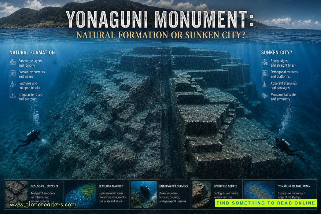
The waters surrounding Japan's remote Yonaguni Island conceal one of the most visually extraordinary and controversial underwater landscapes known in the western Pacific. Resting beneath the sea is an immense mass of layered rock characterized by broad horizontal platforms, abrupt vertical faces, narrow ledges, angular corners and formations that can look remarkably like gigantic staircases. Collectively known as the Yonaguni Monument, these submerged features have generated a debate that reaches far beyond ordinary marine geology. Are they simply spectacular products of natural fracture and erosion, or did human beings modify parts of the formation before rising seas submerged the landscape?
The controversy is especially compelling because neither side begins with an absurd observation. The monument genuinely contains striking geometric forms. At the same time, the geology of Yonaguni is capable of producing surprisingly regular fractures without human intervention. Distinguishing between those possibilities requires more than deciding whether a photograph resembles architecture. It requires examining the rock itself, the regional geology, archaeological context, sea-level history, erosion patterns and the physical evidence that deliberate construction should leave behind.
The result is a fascinating case in which appearance, geology and archaeology do not necessarily point in the same direction.
The monument lies off the southern coast of Yonaguni Island, the westernmost inhabited island of Japan and part of the Ryukyu island chain. Taiwan lies relatively close to the west, placing Yonaguni within a region that has long formed a geographical bridge between the Japanese archipelago, Taiwan and the broader western Pacific.
The submerged formation became widely known after local diver Kihachiro Aratake encountered it in the nineteen eighties while exploring waters around the island. What initially attracted attention was its extraordinary geometry. Instead of appearing merely as an irregular underwater reef, parts of the structure resemble a colossal stone complex.
The principal formation extends across a substantial area and rises dramatically from the surrounding seabed. Divers encounter enormous horizontal surfaces interrupted by steep walls and terraces. Some sections resemble steps descending through the water. Others look like roads, plazas, retaining walls or platforms when photographed from particular directions.
This architectural appearance eventually attracted researchers, divers, documentary filmmakers and advocates of lost-civilization theories. The most prominent supporter of significant human involvement became Masaaki Kimura, a marine geologist who spent years studying the site and argued that some features may represent human modification of an originally natural geological formation.
That distinction is important. The debate is sometimes presented as a choice between an entirely natural rock and an entirely artificial city. A more nuanced hypothesis proposes something between those extremes: a naturally occurring rock formation that prehistoric people may have altered, shaped or incorporated into a larger site.
Much of the controversy begins with the monument's extraordinary terraces. Huge flat surfaces appear stacked at different elevations, sometimes connected by steep transitions that resemble monumental steps. Photographs taken underwater can make these surfaces look astonishingly engineered.
Several features have received particular attention. There are long straight edges, approximately rectangular corners, narrow channels and depressions that appear unusually regular. Divers have identified formations given descriptive names because of their resemblance to familiar architectural objects, although such names do not establish their archaeological origin.
One of the strongest psychological impressions comes from scale. A small angular rock can easily be dismissed as ordinary fracturing. At Yonaguni, however, some geometric surfaces are enormous. A diver swimming alongside them may appear tiny, making the formation resemble the foundations of some monumental complex.
Yet large scale does not automatically indicate construction. Geological processes operate over entire cliffs, mountains and sedimentary layers. If the underlying rock contains extensive bedding planes and systematic joints, erosion can exploit those weaknesses across very large distances.
This is precisely where the natural explanation becomes powerful.
The Yonaguni formation consists largely of sandstone and related sedimentary rocks. Sedimentary formations commonly contain bedding planes, boundaries produced as successive layers of sediment accumulated and later became rock. These layers can create naturally horizontal surfaces.
Rock masses also contain joints and fractures. If major fracture systems intersect bedding planes at relatively consistent angles, blocks can separate along surprisingly straight boundaries. Weathering, wave action and underwater currents then remove weakened material, exposing flat surfaces and sharp-looking edges.
This combination can produce landscapes that appear artificial even when no human has ever touched them.
Yonaguni Island itself provides an important comparison because similar geological tendencies can be observed above water. Exposed rocks around the island show bedding, fractures, angular blocks and surfaces shaped by erosion. Supporters of the natural-origin interpretation therefore argue that the underwater monument is not geologically isolated from its surroundings. Instead, it represents an especially dramatic submerged expression of processes visible elsewhere in the local landscape.
The apparent staircases are particularly instructive. Human observers instinctively associate repeated horizontal and vertical surfaces with architecture. But sedimentary rock can fracture into benches. Differential erosion may remove softer material while more resistant layers remain, creating a sequence of platforms that resembles stairs.
Underwater photography can intensify the effect. Perspective, lighting and the absence of familiar terrestrial reference points can make naturally fractured rock appear even more regular than it actually is.
Supporters of human modification nevertheless point to details they believe are difficult to explain solely through erosion. Some surfaces appear unusually smooth. Certain channels seem narrow and purposeful. Sharp corners and repeated terraces can look as though stone was deliberately removed.
There have also been claims concerning possible carved markings, roads, walls, post holes, drainage features and even representations resembling animals or human-made symbols. Such interpretations remain highly controversial because resemblance is not equivalent to archaeological identification.
This problem is fundamental to the Yonaguni debate. Humans are extremely effective at detecting familiar shapes in ambiguous environments. A natural depression can resemble a quarry mark. A fractured ledge can resemble a road. Intersecting cracks can look like writing. Once a location has been described as a lost city, subsequent observers may unconsciously interpret ordinary geological features through an archaeological framework.
For an artificial structure, archaeologists would normally seek multiple independent categories of evidence. Tool marks would be valuable. Artifacts embedded in secure archaeological contexts would be even stronger. Pottery, worked stone, occupation debris, hearths, human remains, structural foundations or datable cultural deposits could transform the debate.
At Yonaguni, this kind of unequivocal contextual evidence has not established the existence of a submerged city.
That absence does not mathematically prove that humans never modified the formation. Stone landscapes used ceremonially or practically do not necessarily contain abundant artifacts. Marine processes can also destroy or redistribute archaeological materials. Nevertheless, extraordinary architectural interpretations require positive archaeological evidence rather than simply an inability to explain every unusual-looking rock surface.
The question of sea level creates another major challenge.
If substantial portions of Yonaguni were shaped by people while exposed above water, the modification would have to date from a period when sea levels were significantly lower than today. During the last glacial period, enormous quantities of water were locked within continental ice sheets. Global sea level was therefore much lower. As the climate warmed and ice sheets melted, coastlines retreated and low-lying landscapes around the world disappeared beneath rising seas.
This means that the general concept of submerged prehistoric landscapes is completely scientifically plausible. Archaeologists already know that vast territories occupied by prehistoric humans now lie underwater.
The difficulty is determining whether this particular formation was culturally modified while exposed.
If major human construction occurred there before postglacial sea-level rise submerged it, the required antiquity could push activity back thousands of years into prehistoric periods when societies in the region are not known to have constructed monumental stone architecture comparable to what the most dramatic Yonaguni interpretations imply.
That creates an archaeological problem. A genuine enormous stone complex would not merely change the history of Yonaguni. It could require significant reassessment of prehistoric technological and social development in the region.
Such a revision is possible in principle. Archaeology has repeatedly changed when new discoveries emerged. But major revisions require proportionately strong evidence.
The frequently used phrase "sunken city" can therefore be misleading. It encourages an image of buildings, streets, temples and organized urban settlement. The physical reality at Yonaguni is a massive geological formation whose surfaces sometimes resemble architectural forms. Even if future research demonstrated human modification, that would not automatically establish the existence of a city.
A prehistoric community could have modified a natural promontory without constructing an urban center. People throughout history have transformed natural cliffs, caves, hills and rock outcrops for ceremonial, defensive, funerary or practical purposes. Under such a scenario, Yonaguni could theoretically be both geological and archaeological at the same time.
This hybrid hypothesis is one reason the monument remains intellectually interesting.
Suppose prehistoric people encountered a naturally terraced sandstone formation when sea levels were lower. They would not need to carve the entire monument from solid rock. Instead, they could enlarge existing ledges, remove loose blocks, straighten selected surfaces or create pathways between naturally fractured terraces. The resulting landscape might combine obvious geological structure with localized human modification.
Demonstrating this, however, would require identifying features that cannot reasonably be attributed to natural fracture and erosion and then connecting those features to datable human activity.
One potentially useful approach would be detailed three-dimensional mapping of the entire formation. Individual photographs can exaggerate geometric regularity because photographers naturally select dramatic viewpoints. A comprehensive three-dimensional model allows researchers to examine whether apparently straight walls remain straight over their full extent, whether supposed staircases maintain consistent dimensions and whether alleged architectural features form a coherent spatial plan.
A genuine engineered complex should display patterns of intentional organization that extend beyond isolated visually impressive surfaces.
Microscopic examination of rock surfaces could also help distinguish natural breakage from deliberate working. Repeated impact scars, systematic percussion patterns or characteristic tool traces would provide much stronger evidence than shape alone. Unfortunately, underwater erosion and biological activity complicate such analysis, particularly if hypothetical modification occurred thousands of years ago.
The surrounding seabed is equally important. If people occupied the area, archaeological materials might exist beyond the main monument. Systematic surveys could search for concentrations of worked stone, pottery, organic remains or other evidence of human activity. Dating any securely associated material would be crucial.
Without such evidence, the debate remains dominated by morphology: what the rocks look like.
Yonaguni also demonstrates how difficult visual interpretation can become underwater. Water changes light, contrast and perceived distance. Marine growth obscures surfaces. Sediment fills cracks. Strong currents affect both diving conditions and long-term erosion. Large structures cannot always be viewed from a single perspective, forcing observers to reconstruct their shape mentally from separate dives, photographs and video sequences.
The monument is therefore particularly vulnerable to selective presentation. Images showing the most rectangular terraces can make it appear overwhelmingly artificial. Images showing fractured surrounding geology can make it appear obviously natural. Both may depict genuine portions of the same site.
A rigorous interpretation must examine the entire geological context rather than only its most spectacular features.
Another problem involves terminology. Calling a feature a "staircase," "road," "gate" or "wall" subtly embeds an interpretation within its name. A staircase is, by definition, something constructed or arranged for movement between levels. A stepped geological bench is not a staircase merely because humans could climb it.
Scientific descriptions therefore benefit from neutral language: terrace, ledge, fracture, channel, depression, block and vertical face. Once those features are independently demonstrated to have been modified, architectural terminology becomes more defensible.
This distinction may seem semantic, but it influences how evidence is perceived.
The Yonaguni controversy is often connected in popular culture with stories of Mu, Atlantis-like civilizations and technologically sophisticated societies destroyed by ancient catastrophes. Such narratives are compelling, but they introduce claims far beyond what the monument itself can demonstrate.
Even if Yonaguni eventually proved to contain human modifications, that discovery would not validate stories of a globally advanced lost civilization. Archaeological conclusions must proceed incrementally. Evidence of modification would demonstrate modification. Evidence of ritual use would demonstrate ritual use. Evidence of settlement would demonstrate settlement. A city would require evidence appropriate to a city.
The strongest current interpretation therefore does not require either sensationalism or absolute certainty.
The geological explanation accounts effectively for many of Yonaguni's most striking characteristics. Sedimentary bedding can produce broad horizontal surfaces. Joint systems can generate straight fractures and angular blocks. Differential erosion can create terraces and step-like profiles. Similar patterns visible around Yonaguni strengthen the argument that natural processes played the dominant role in creating the monument.
At the same time, the possibility of limited prehistoric interaction with the formation cannot be dismissed merely because the underlying structure is natural. Humans have modified natural landscapes throughout their existence. If Yonaguni was exposed during periods of lower sea level, prehistoric visitors could theoretically have used or altered portions of it.
The unresolved question is not whether ancient humans were capable of touching or modifying rock. It is whether clear archaeological evidence demonstrates that they actually did so at Yonaguni.
So far, the spectacular geometry has attracted far more attention than unequivocal archaeological material.
That makes the Yonaguni Monument scientifically valuable regardless of whether a lost settlement ever existed there. If entirely natural, it is an exceptional example of how sedimentary structure, tectonic fracturing and marine erosion can create monumental geometry capable of deceiving even experienced observers. If evidence of human modification is eventually confirmed, it could provide a remarkable window into prehistoric coastal activity in a landscape later swallowed by rising seas.
Perhaps the greatest lesson of Yonaguni is therefore methodological. Nature is capable of producing structures that look designed, while humans frequently build by exploiting structures nature has already created. Separating those two processes demands more than visual intuition.
The mystery will not be solved by asking whether the monument looks like a city. The decisive questions are whether its geometry exceeds what local geology can naturally produce, whether identifiable traces of deliberate stoneworking exist, whether archaeological materials occur in secure association with the formation and whether those materials can establish when and how humans used the site.
Until evidence answers those questions decisively, the enormous terraces beneath Yonaguni will remain suspended between two compelling interpretations: a geological masterpiece shaped by fracture, erosion and the sea, or a natural monument that prehistoric people encountered and perhaps transformed before rising oceans concealed it beneath the waves.



 Château de Carcassonne: Europe’s Greatest Medieval Citadel and Fortress
 Château de Chenonceau: The Castle Built by Remarkable Women
 Château de Chambord: France’s Magnificent Renaissance Castle and Architectural Wonder
 Tehri Dam: India's Tallest Dam and the Debate Behind It
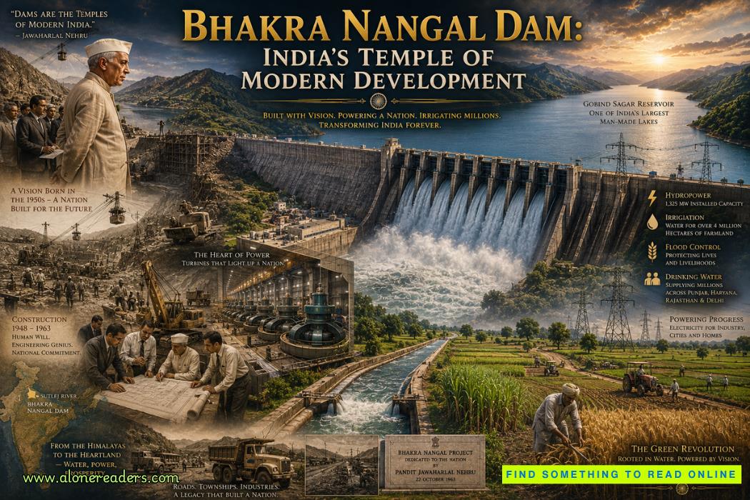 Bhakra Nangal Dam: India's Temple of Modern Development
 Mangla Dam: Pakistan's Second Great Water Project